


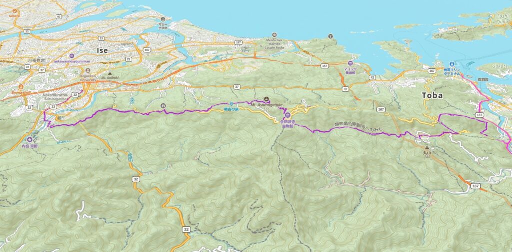
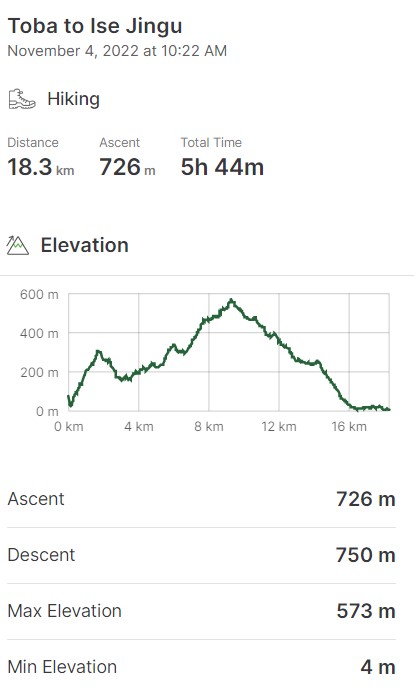
Stretching over 15.3 km through the forest, this hiking trail will cross two “summits” (don’t start packing your rope and ice axe, the highest one we will climb is 500 meters).
This hike will be divided into four main sections:
The first section connects the starting point, Shirataki Damyojin, to the summit of Mount Gyoja.
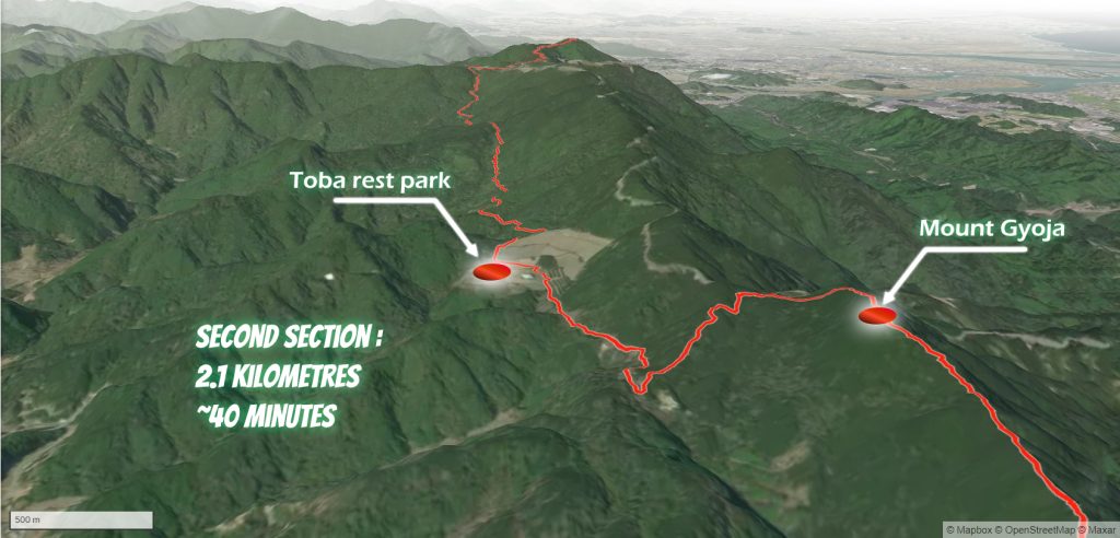
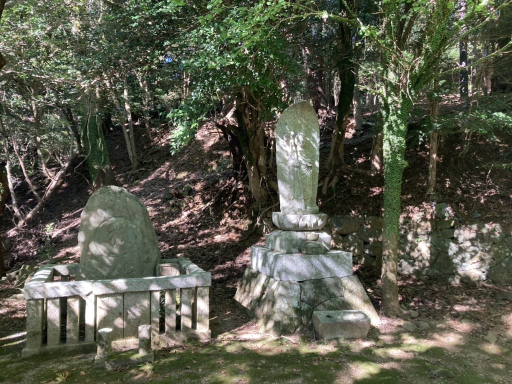
The second section goes from the top of Mount Gyoja to Toba Rest Park (a huge cemetery built in the middle of the forest).
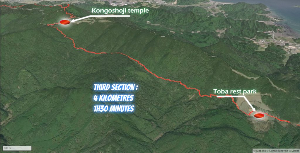
The third section is from Toba Rest Park to Kongoshoji Temple, a beautiful place nestled in the foothills of Mount Asama.
The fourth section goes from Kongoshoji Temple, across Mount Asama, to Ise town and Ise Jingu naiku.
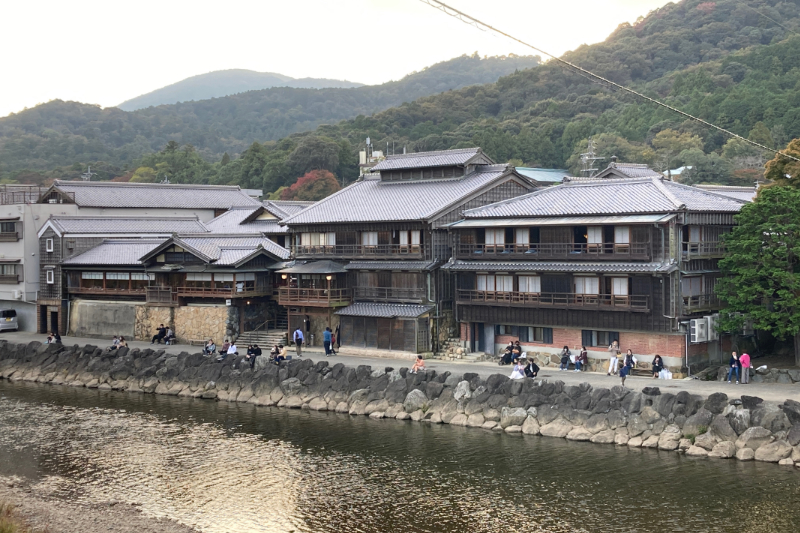
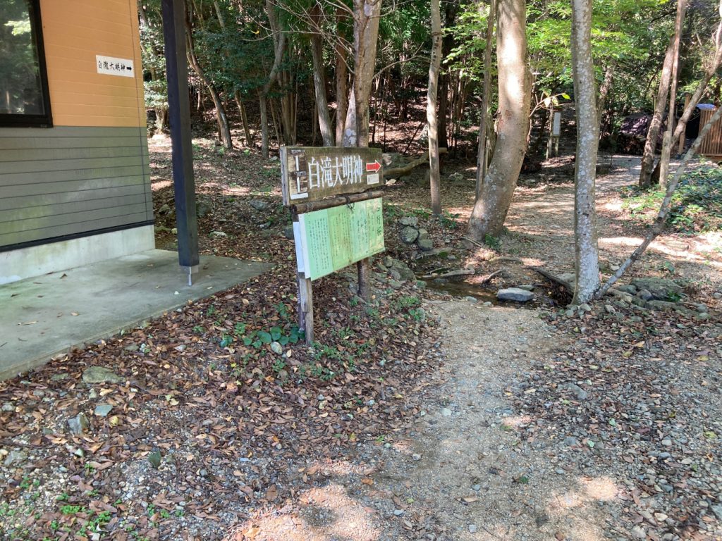
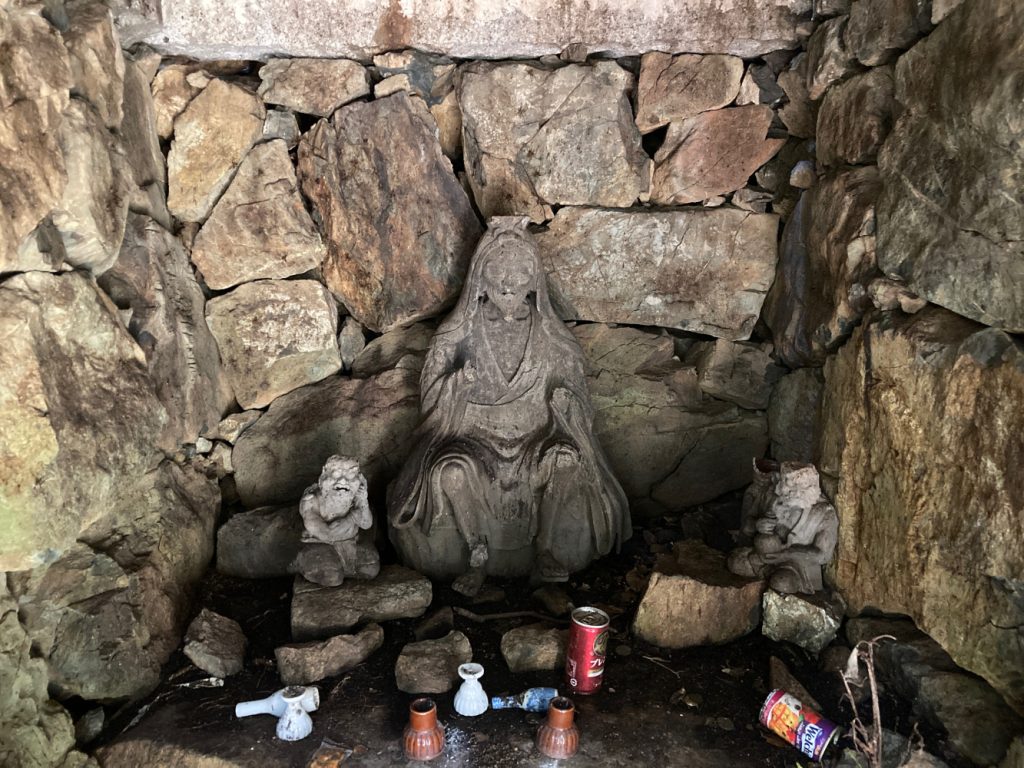
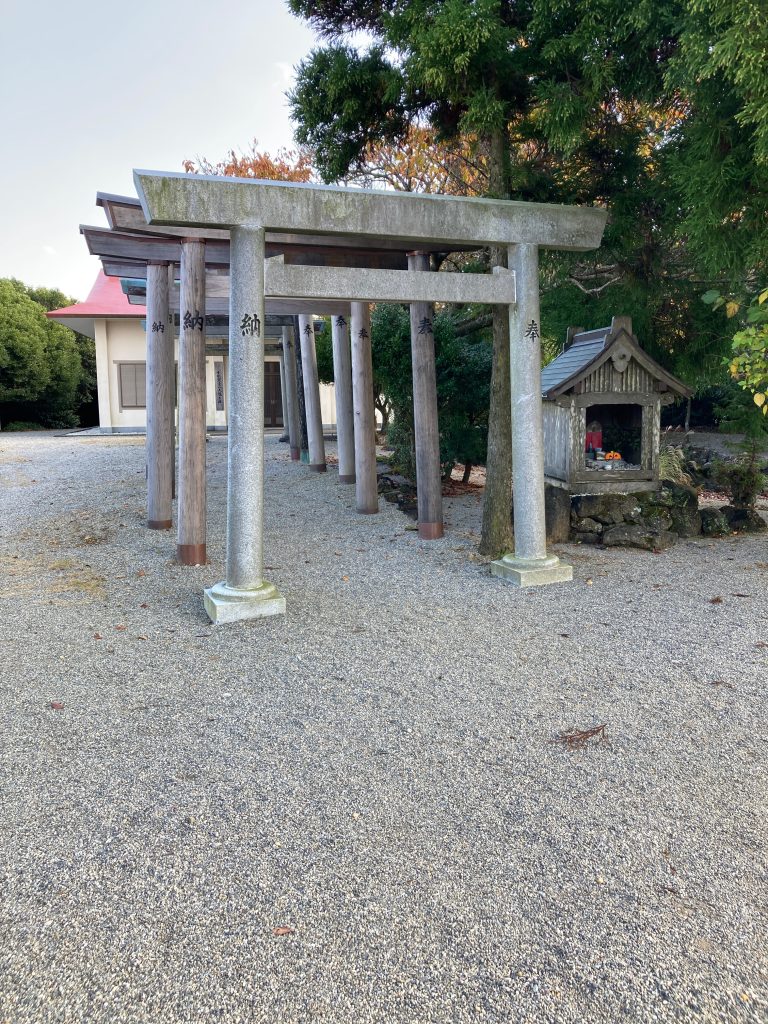
The starting point for this hike is Shirataki Damyojin.
There are two options:
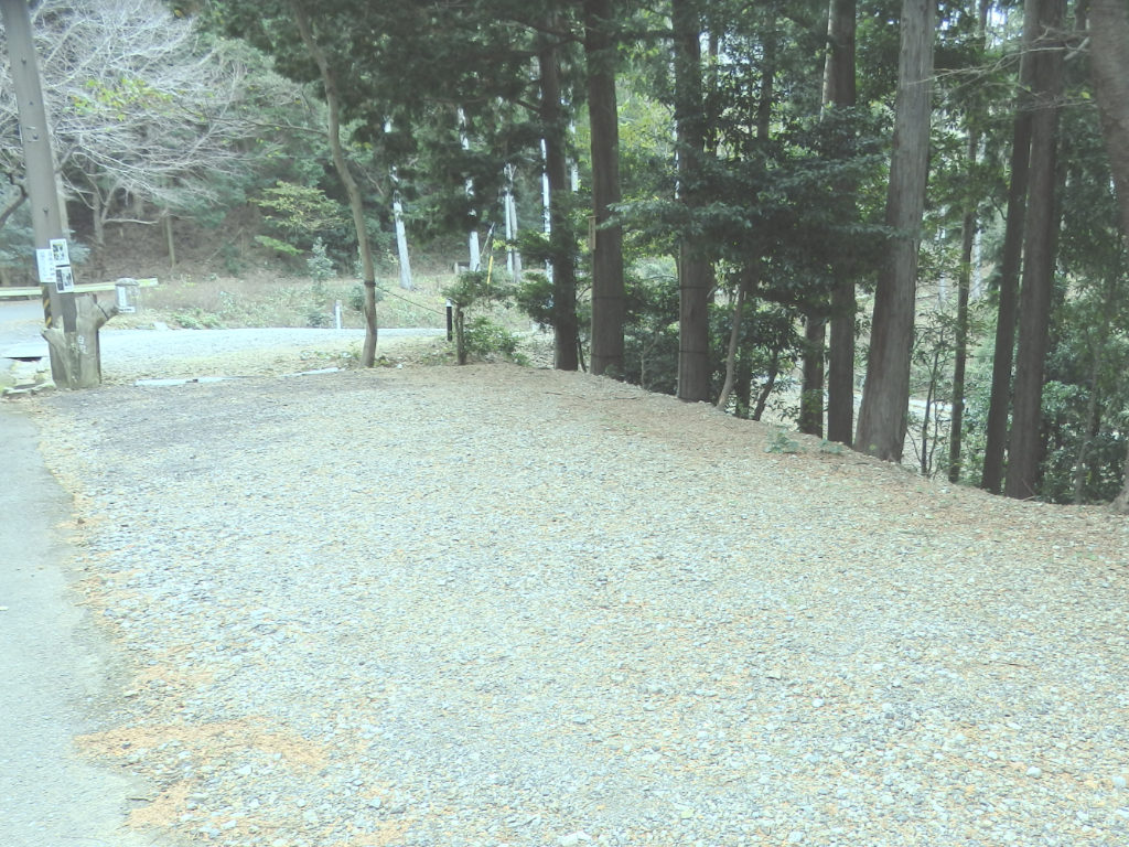
- Option 1: If you choose to come by car, you can park at the car park at the top of Shirataki Damyojin (see photo below).
- Option 2: There is a train stop (Funatsu), a 5-minute walk from Shirataki Damyojin (video explanation on YouTube).
It takes 8 minutes to reach Funatsu station from Toba station.
- At Toba train station, board a local train to Kashikojima.
- It takes about 8 minutes to reach Funatsu train station
- The one-way fare is 230 yen.
Specificity of this hike:
Regardless of whether you go by car or by train, once you reach the Ise Shrine, you must return to Toba by train. Once in Ise, the easiest way is to walk to Isuzugawa station (1.5 km walk) and take the train back to Toba. So, if you decide to leave your car at Shirataki Damyojin, you will still have to take the train to Funatsu station to get your car back.
A single ticket from Isuzugawa station to Funatsu station costs ¥380 for a 20-minute ride.
Between Isuzugawa station and Toba Station, it will cost you 300 yen for a 12-minute ride.
| Alt. max 550m | Access. car・bus | 15.3km trail |
 | ||
| Car park (free) | Duration 6h00 | Trail with washrooms |
 |  | |
| Beginner level No | Rec. season All except summer and rainy season( June/July) |
| | | |||||
| Alt. max 550m | Access. car・bus | 15.3km trail | Car park (free) | Duration 6h00 | Trail with wash. | Beg. level No | Rec. season All except summer and rainy season(Jun./Jul.) |
※Gaia GPS is a hiking app which covers the latest route status and other climbing information with extensive coverage of trails all over Japan.
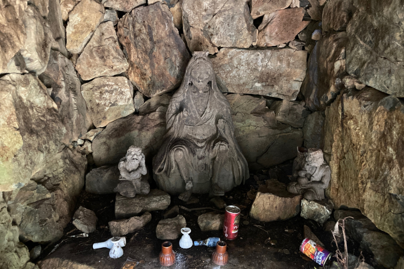
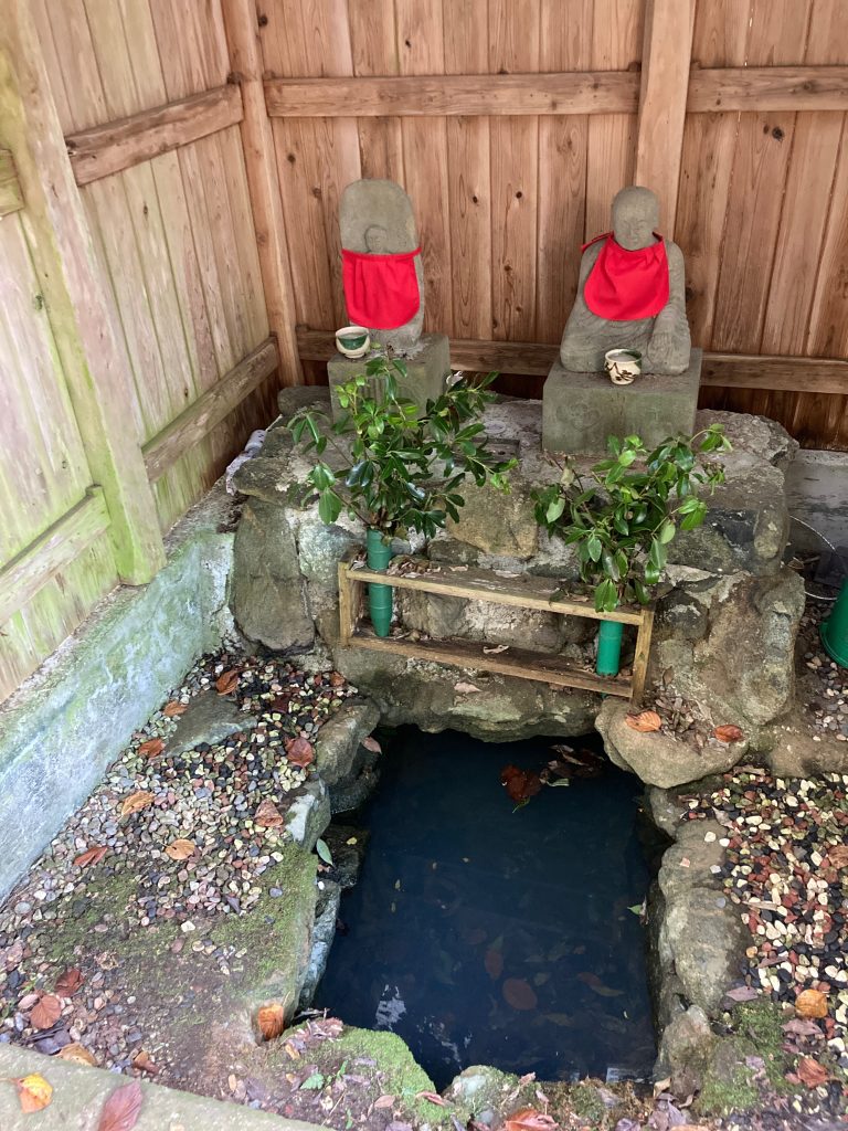
From Shirataki Damyojin (waterfall meditation) to Gyoja mountain
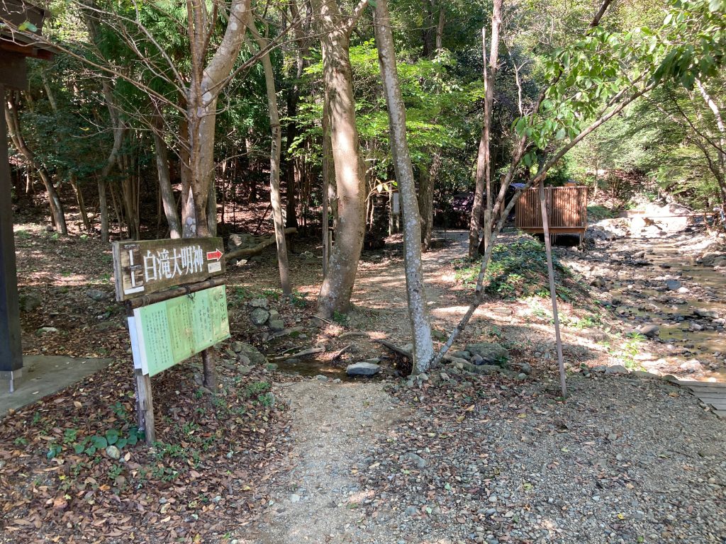
The starting point for this hike is Shirataki Damyojin, a place dedicated to waterfall meditation just outside Toba. It is easily accessible both by train (stop at Funatsu station), and by car (parking is available 200 meters from the starting point).
First section: Gyoja mountain
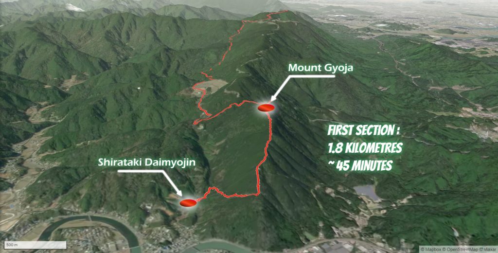
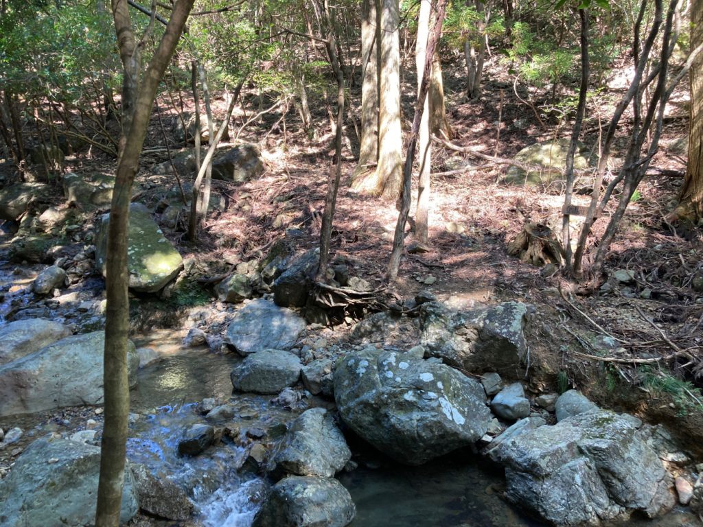
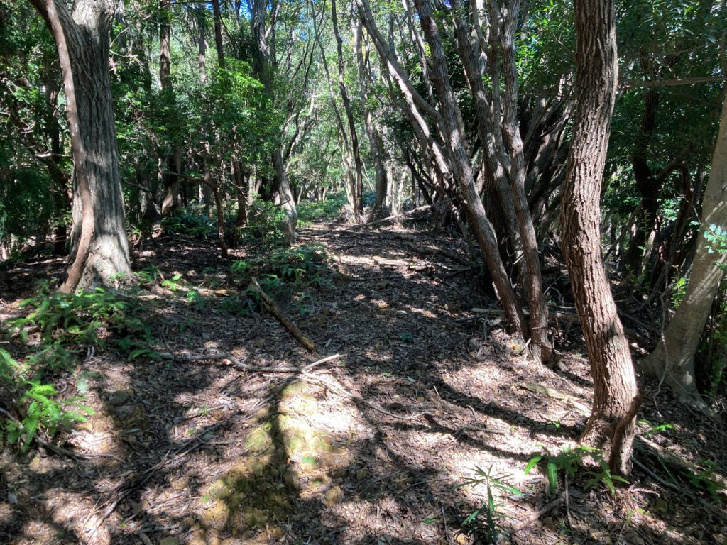
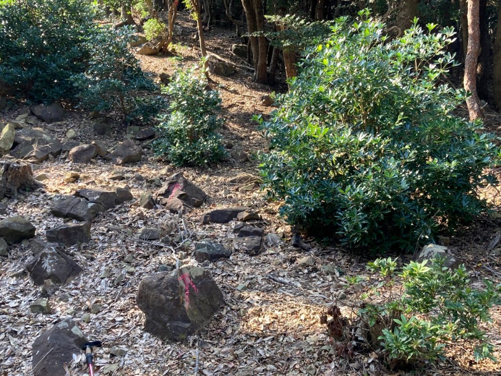
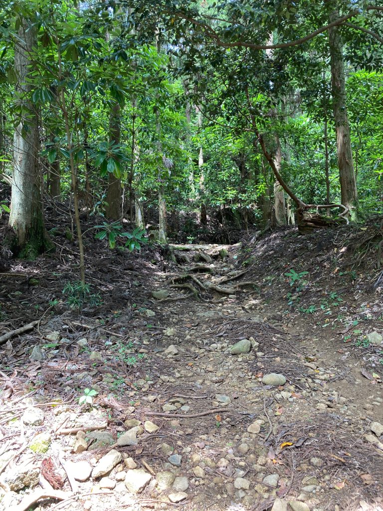
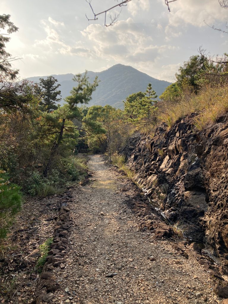
From the Shirataki Damyojin grounds, it takes 45 minutes to reach the top of Gyoja Mountain. The path winds its way through the forest to the top. Although it is regularly marked with red ribbons, it is very easy to deviate from the trail. But don’t worry, the main thing is to climb to the ridge and then turn left, following the path on the ridge, until you reach the top of Gyoja Mountain.
The top of Mount Gyoja
We’ve arrived at “point of interest ①” , Mount Gyoja!
In Japan, a Gyoja is a person who follows ascetic pratice. Gyoja mountain was once the training ground for those people who chose to lead a life based on meditation and strict mental and physical discipline.
 ガイドのタコ
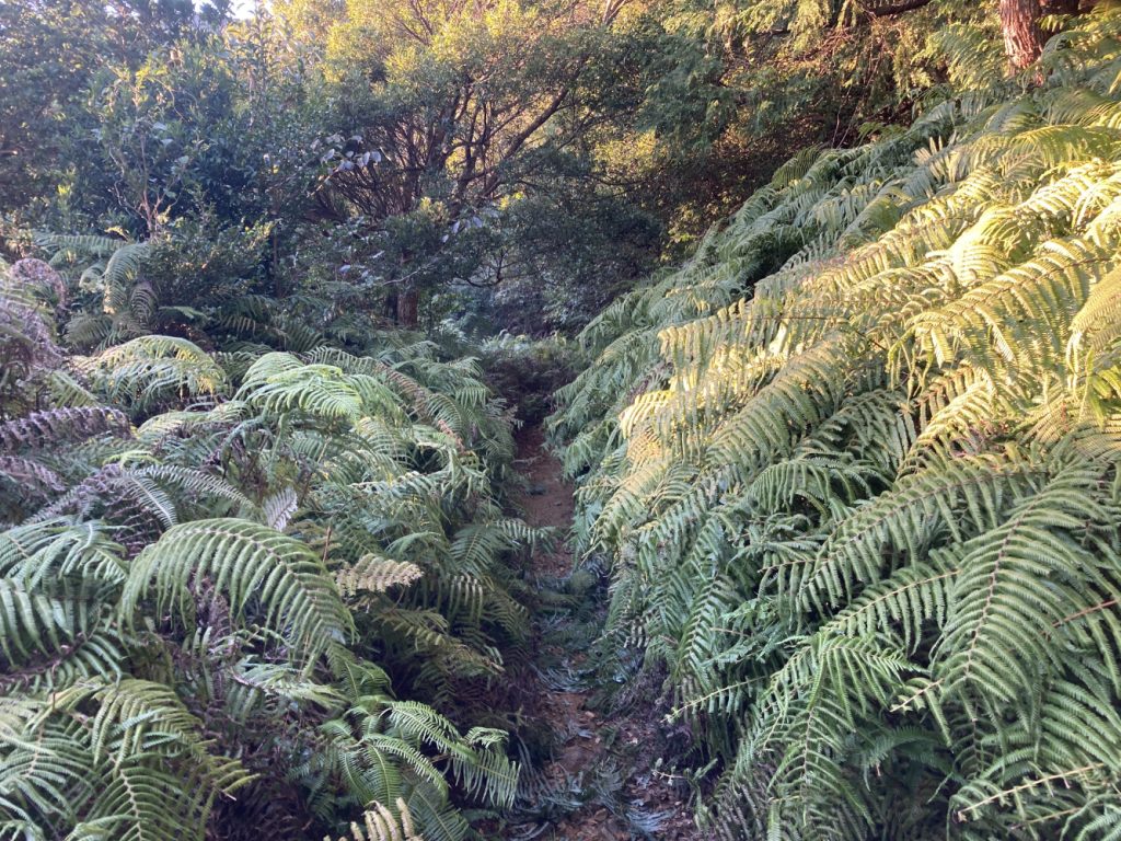
The ground is very uneven and sometimes covered with ferns so be sure to wear appropriate shoes and clothing.
Second section : Mount Gyoja to Toba Rest Park

Third section : Toba Rest Park to Kongoshoji temple
shadows are pleasant
The third section is a bit more difficult, not so much in terms of gradient, but as the trail is in the valley, some landslides tend to occur, especially during the rainy seasons (June-July and October) and in some places it can be easy to lose the trail.
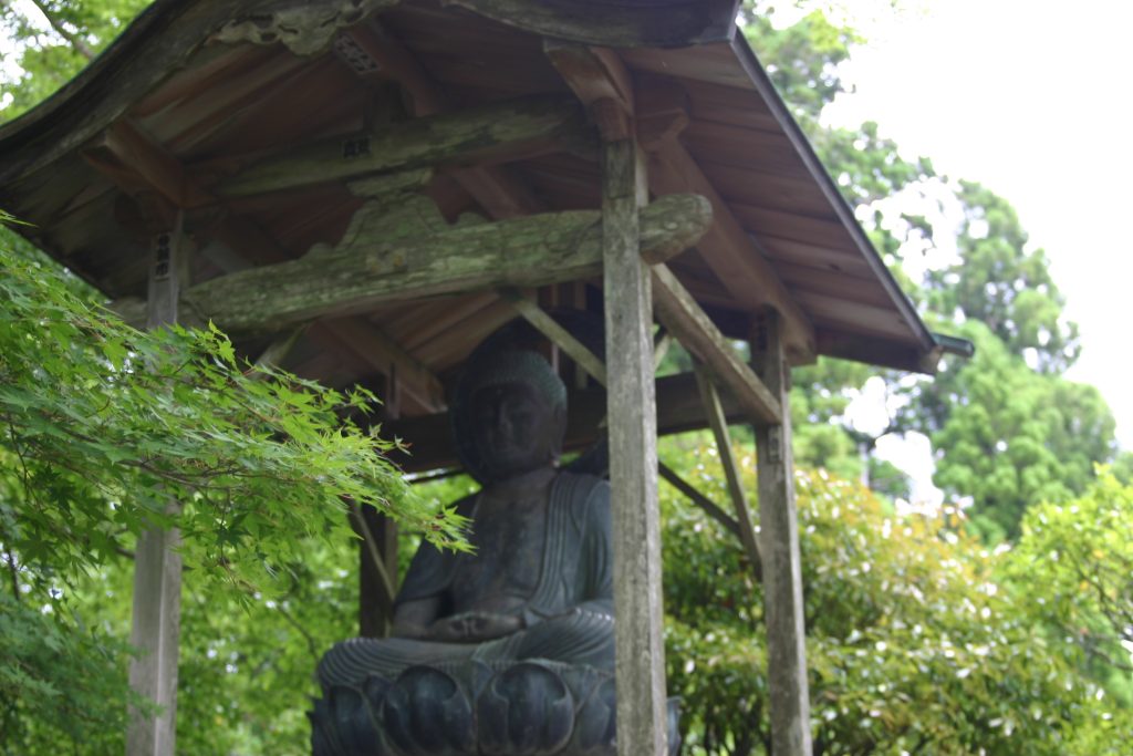
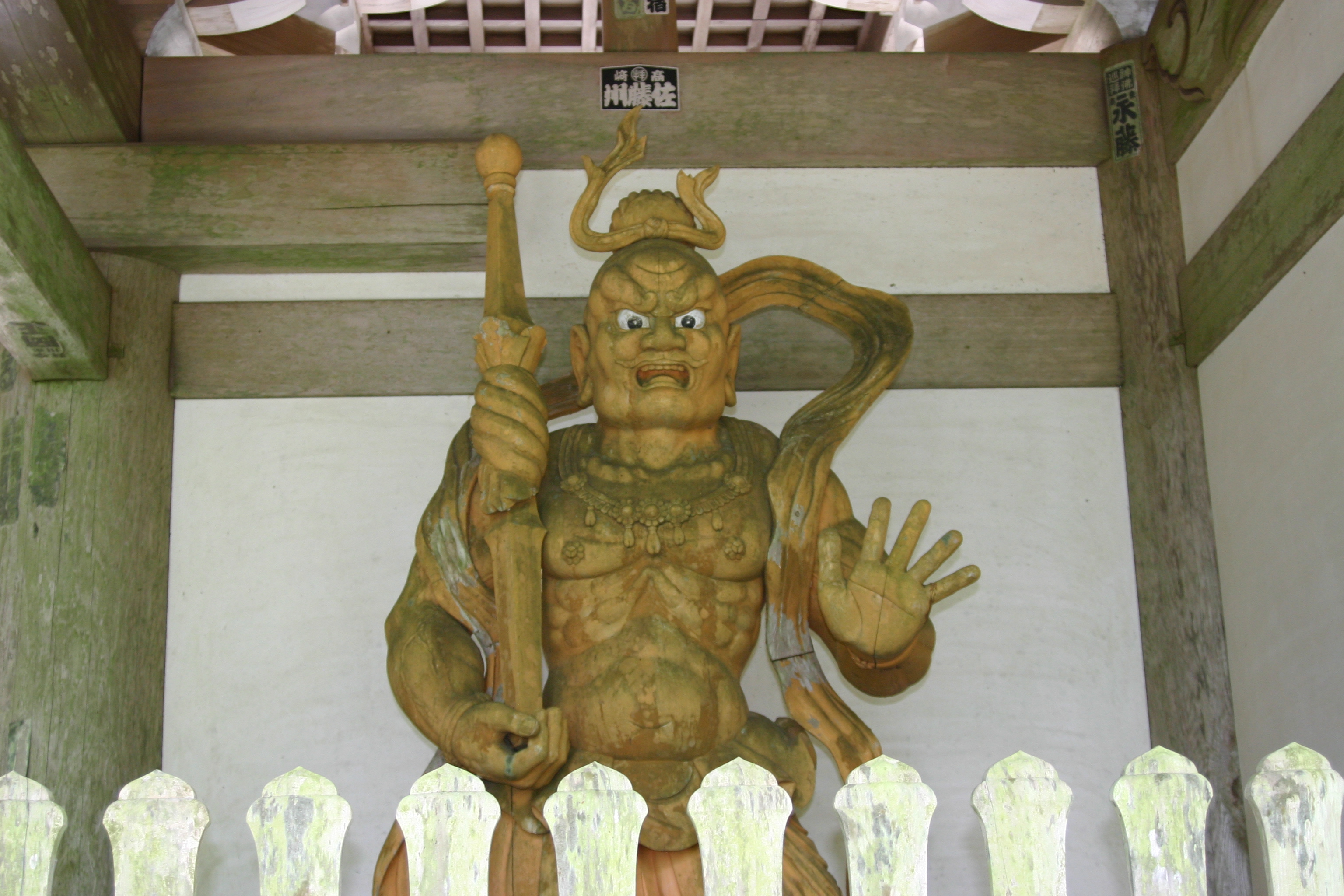
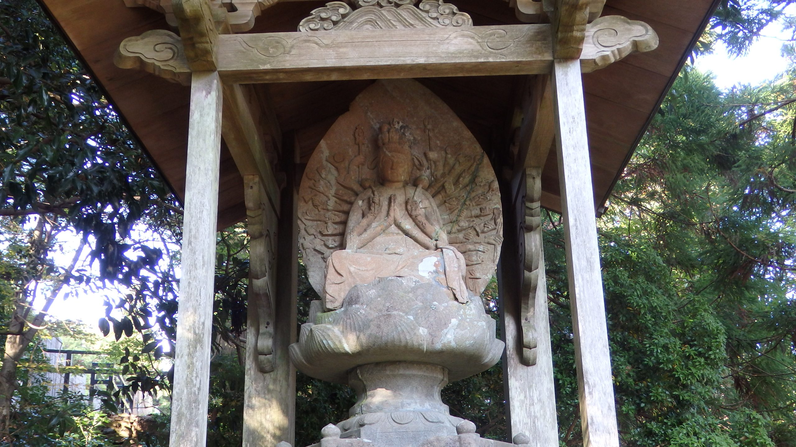
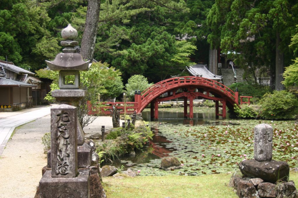
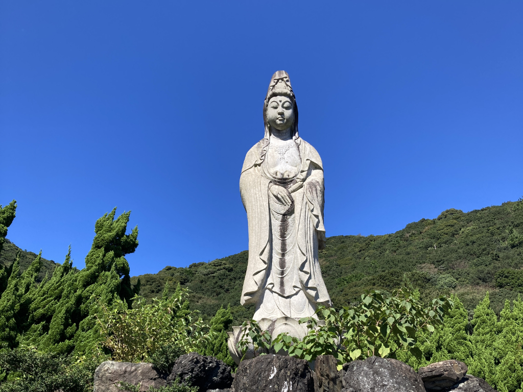
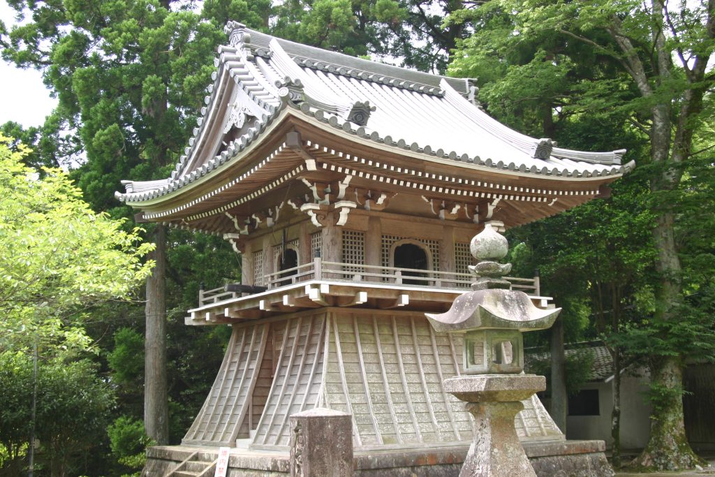
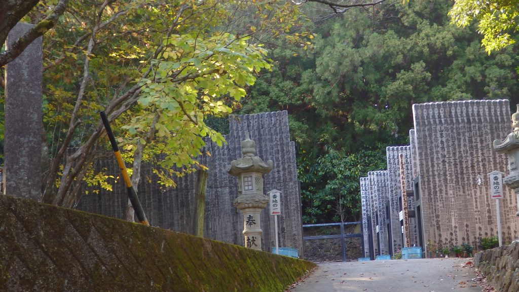
We have reached “point of interest ②”, kongoshoji temple.
Kongōshō-ji (金剛證寺) is a Rinzai school, Zen Buddhist temple in the Asamacho neighborhood of the city of Ise, Mie Prefecture Japan. Its main image is a statue of Kokūzō Bosatsu. Founded in the Asuka period, it has been closely associated with the Ise Grand Shrine throughout its history and contains numerous National Treasures and Important Cultural Properties (From Wikipedia)
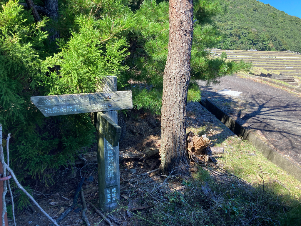
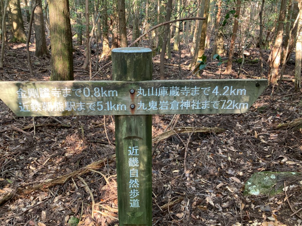
The entrance to the fourth section of the road is located halfway between the Temple and the cemetery. This short video will help you visualise the situation.
Fourth section : from Kongoshoji temple to Ise Grand Shrine
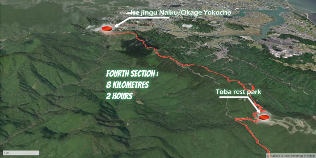
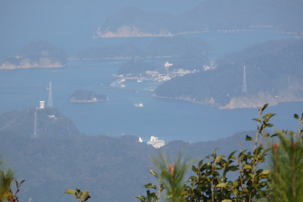
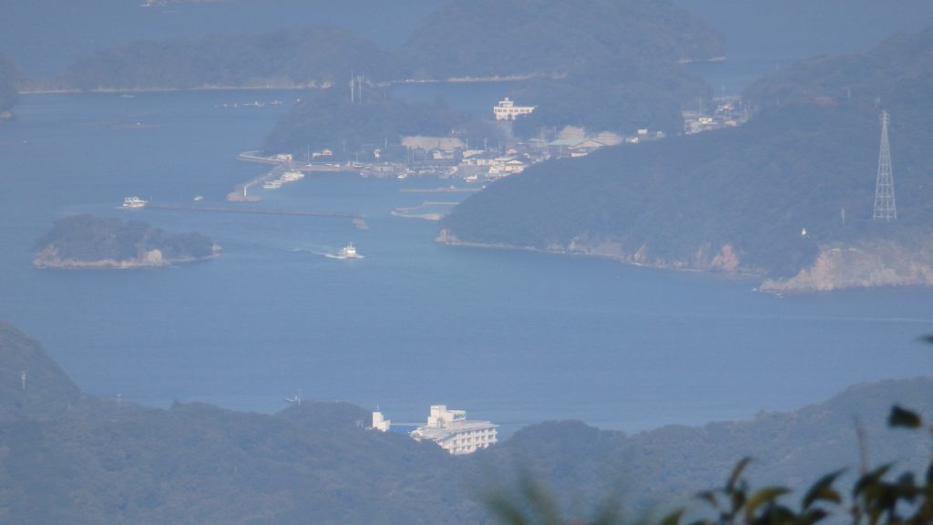
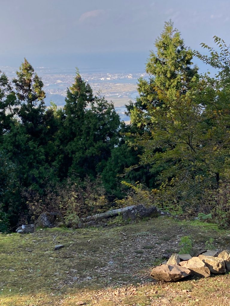
About 700 metres from the entrance is the “summit” of Mount Asama. At the top is the Hachidai Ryusha Shrine, and from there you can enjoy a magnificent view of Ise and Toba.
The Ise Grand Shrine (伊勢神宮, Ise Jingū), located in Ise, Mie Prefecture of Japan, is a Shinto shrine dedicated to the sun goddess Amaterasu. Officially known simply as Jingū (神宮), Ise Jingū is a shrine complex composed of many Shinto shrines centered on two main shrines, Naikū (内宮) and Gekū (外宮).
The Inner Shrine, Naikū (also officially known as “Kōtai Jingū”), is located in the town of Uji-tachi, south of central Ise, and is dedicated to the worship of Amaterasu, where she is believed to dwell. The shrine buildings are made of solid cypress wood and use no nails but instead joined wood. The Outer Shrine, Gekū (also officially known as “Toyouke Daijingū”), is located about six kilometers from Naikū and dedicated to Toyouke-Ōmikami, the god of agriculture, rice harvest and industry. Besides Naikū and Gekū, there are an additional 123 Shinto shrines in Ise City and the surrounding areas, 91 of them connected to Naikū and 32 to Gekū.
The chief priest or priestess of Ise Shrine must come from the Imperial House of Japan and is responsible for watching over the Shrine. The current high priestess of the shrine is Emperor Emeritus Akihito’s daughter, Sayako Kuroda. (Wikipedia)
 見守りのカモメ
Once you’ve caught up your breath, head to Isuzugawa train station.
Q&A
 Hikerガイドのタコ
 悩めるHiker見守りのカモメ